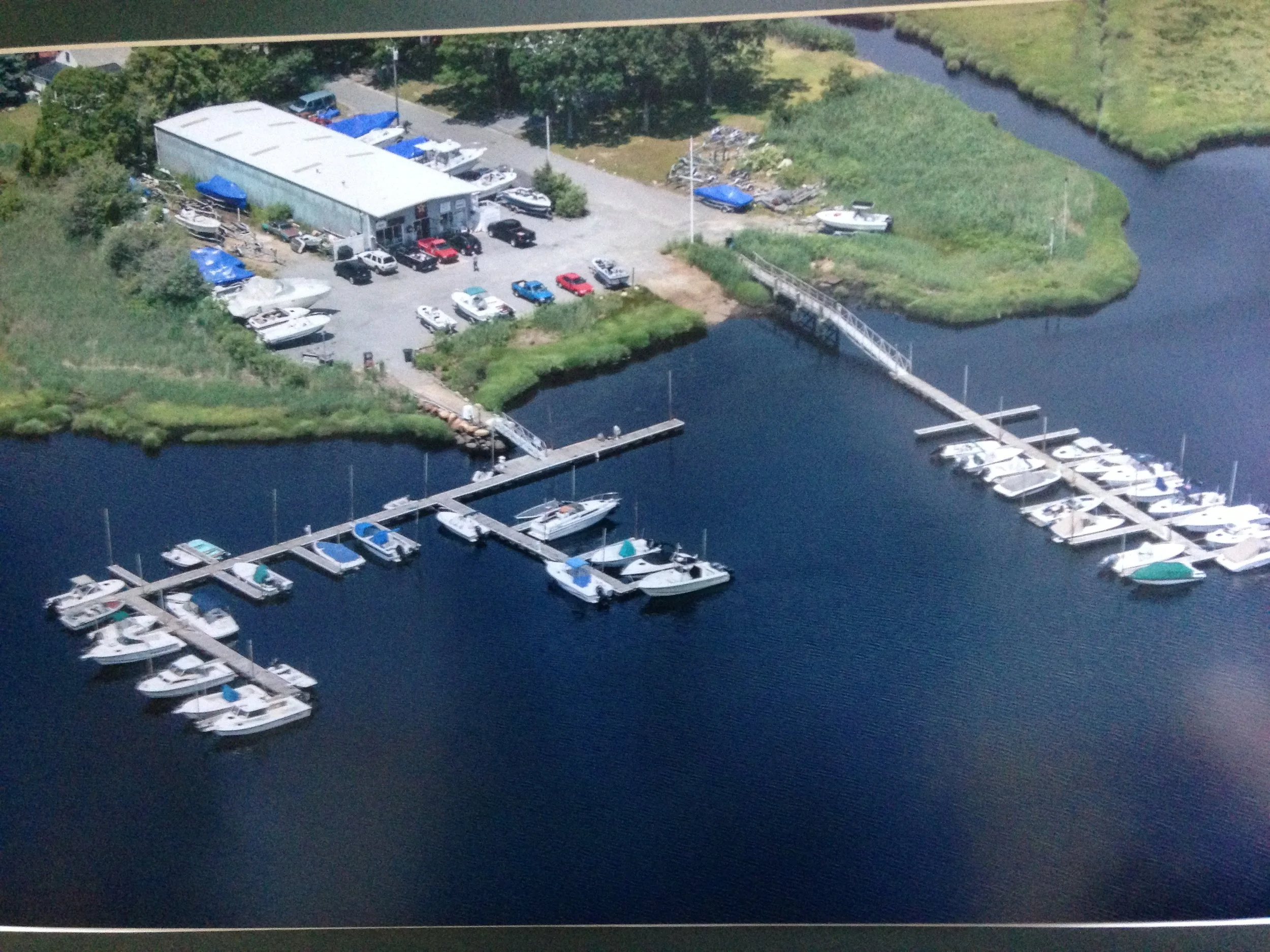
The Wareham Marina
Lowest prices in the area on summer and winter storage, shrink wrapping, bottom painting and all mechanical work!
Our mechanics have over 50 years of outboard and inboard experience, including all summerization, winterization, repowers and all you inboard or outboard motor needs. While we are a certified Mercury dealer and use OEM Mercury parts, we also work on all makes and models of inboards and outboards; Suzuki, Yamaha, Evenrude, Tohatsu and more!

The new and improved Wareham Marina is all about ease and accessibility. Only minutes from Buzzards Bay and Martha’s Vineyard, Wareham Marina is the most affordable and fastest way to great boating on Cape Cod.
The Weweantic River is prime Striped Bass fishing, with great early and late season fishing throughout the river. The Rose Point area is known for some of the best fishing in Buzzards Bay.
Slips and Storage

With 50+ slips and moorings Wareham Marina has the right fit for your boat. Contact us today to check on availability.
Yard Services

At Wareham Marina you can focus on boating. With on site fuel, maintenance and service we keep you moving!
Mercury Platinum Dealer

Wareham Marina is a certified Mercury Platinum Dealer. What that means for you is lowest price on the most complete line of outboards to power any boat.
“I took my boat out twice a year at most when I had to trailer it every time. It’s so easy now. I can actually enjoy my boat.”-Bob